
Full Services List
Residential Roof Inspection
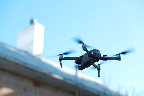
Aerial asset inspection of residential houses has quickly replaced the need for on-roof inspection. Working at heights risks and possible roof damage have been eliminated. By taking a series of detailed photos an assessment can be completed without the need for you to even be at home! We can also give you a photographic record of your roof and its condition - a useful benchmark to have.
Asset inspection
Some assets are complex and aren't easily accessed by people working at heights. Drones eliminate the risk to injury as well as gaining vantage points otherwise inaccessible to provide a truly thorough asset inspection. This includes such things as towers, heritage structures, solar farms and wind turbines.

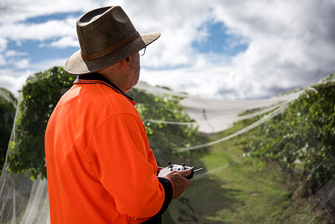
Drones are the natural partner of those with environment protection and land management responsibilities. Whether you are a farmer, natural resources manager, land care professional or biosecurity officer, drones can access and record large areas quickly, giving you a high resolution photo map of native flora, invasive weeds and pests, the state of riparian zones and evidence of human activity. Record project progress on stabilisation works, wetland rejuvenation or bush regeneration without boots on the ground or struggling to access remote locations. Using multispectral imaging, data about the health of flora, invasive or native, can also be gathered.

Drones require specific knowledge and skill to use commercially or for your work. However that doesn't mean every use-case requires a full remote pilots licence, which can be time consuming and expensive. Operating in what CASA call the "excluded category" we can get you up to speed with a tailored syllabus that includes safe, effective flight planning and execution as well as practical flying skills.
High Resolution Orthomosaic Imaging
When looking at land or structures, one tends to think about satellite images. However drones can provide a higher resolution image of any commercial or agricultural site or areas of natural bushland, waterways, wetlands and riparian zones. This imaging can be used for promotional and story-telling purposes, compliance, project progress reporting and monitoring changes over time.

Plant health is fast becoming one of the most useful tools in any agricultural or viticultural setting. Understanding how the crops are reacting to care can mitigate loss and increase harvest yield and quality. Using a multispectral payload we're able to create a 2D map image overlay with a visual representation of crop health.

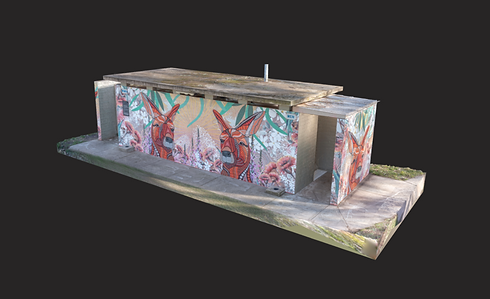
3D Modelling
Through machine learning and leading edge software, 3D imaging is becoming a valuable tool with many useful applications. Using tailored flight plans and geometric photographic stitching we're able to create a 3D model for almost any application. This could be a building for asset management or promotional purposes, digital preservation of heritage structures and objects, cultural and historic items for virtual museum collections and much more.
Weed Identification
Using both RGB and Multispectral imaging, drones can cover large areas and record photos and spectral data to assist in identifying and eliminating weeds. This can be done in either an agricultural, biosecurity or land care context. We work with you and other specialists to gather and analyse data with the aim of developing eradication or containment strategies.

As excellent as solar power is, like all power production, it benefits greatly from monitoring to make sure it's operating at peak performance. Thermal aerial imaging allows us to see beyond the visual limitations of the human eye to detect anomalies that can significantly reduce your power output.

Vine Vigour
Vine vigour is one the the outcomes of NDVI mapping using the multispectral drone. Tracking the rate and density of growth across the season is paramount to making sure that all the hard work that goes into the vines is ultimately working like it should. Having ongoing vine vigour tracking allows you to make adjustments before crops show physical damage.

Construction Progress
Across a large construction site it's difficult to see how much work has been completed. More common now are interval "fly-overs" across the lifetime of the site. This allows updates for stakeholders to see progress in a much more real-time setting and provides a record of project progress. It can also produce some valuable promotional footage.

Site Survey
Being able to visualise your entire site whether that's in construction or a major manufacturing operation, is very useful. Site "walk-arounds" don't always give you the full picture and ultimately aren't able to be kept as a record. Capturing the full view gives you the total picture.

Volumetric Surveys
Using a combination of 3D modelling and highly accurate RTK equipped drones, we're able to measure both positive and negative volumes with great accuracy. Estimating construction material stock levels, quarry mining levels, landfill levels are just a few of the applications.

Wildlife Audits
Wildlife audits have traditionally been done on foot with a team physically counting animals or animal scat. Now with drones and thermal technology at our fingertips we can conduct structured flights over a selected area and more easily detect and count wildlife. This saves time and resources. This approach is also useful for cattle audits and determining the location, population numbers and points of ingress/exit of invasive pests such as feral pigs.

Aerial Photography and Cinematography
Drones have become well known for having a unique vantage point when it comes to cinematography and photography. Alongside sensing data we also are equipped to take photos and video. Equipped with Hasselblad cameras we're able to capture 4k footage and full HD up to 120fps alongside a 20 megapixel still image capability.

Still Can't Find a Service?
If you've got a problem you think we could solve, contact us HERE
